How To Camp In New York When The Campgrounds Are Crowded - 11 minutes read
 You thought you had the perfect idea for a quick getaway: camping out in the Catskills with your cutiepie for some peak leaf-peeping. But all the official campgrounds you found on the internet are crowded with people, like yourself, seeking respite from the pandemic.
Thanks to the foresight of earlier New Yorkers, the Empire State holds about five million acres of public lands. These include state parks, state forests, the forest preserve and public easements that guarantee access to select private lands.
While the relatively few state parks that allow camping mostly allow it only by permit at designated locations, New York allows what it calls "primitive camping" on its other public lands.
Primitive camping is not for everyone. It means a three-sided wooden shelter called a "lean-to” or a flat spot to pitch a tent. Some primitive campsites have a spring or brook for water and a pit privy to relieve yourself in. Many do not.
The best primitive campsites are near a swimming hole or mountain top view. But short of hiring a professional guide, how do you find these wild places? To answer that question, it helps to know how New York classifies its public land. What follows is a primer on public lands and primitive camping opportunities in New York.
This is not a guide to secret places. Those will be yours to find, and keep secret.
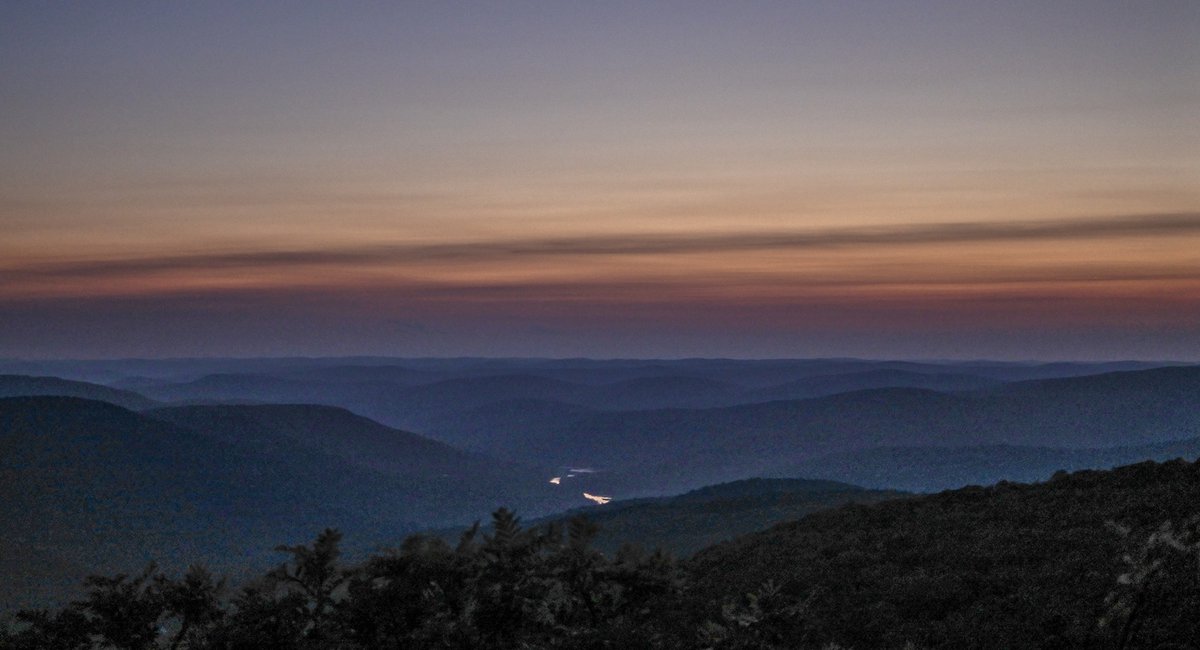
arrow Slide Mountain Wilderness in the Catskills JB Nicholas
State Parks
The New York State park system has a total of 250 public facilities occupying nearly 350,000 acres. These include 180 state parks and a slew of historic sites, golf courses, swimming pools, cabins, and more than 8,000 camp sites.
Generally, state parks allow camping by permit only. One that allows primitive camping without a permit is Harriman State Park. You’re allowed to camp within 300 feet of any of its 9 lean-tos.
Because Harriman is so close to New York City (roughly a 90 minute drive), its primitive camp sites have been heavily used since the start of the COVID-19 pandemic. More primitive campsites abound in Harriman away from its lean-to sites. These are technically illegal, "stealth" campsites. You can find a stealth campsite apart from the crowds if you are not afraid of rattlesnakes, the remote possibility of a fine, and can traverse a trail-less section of forest.
Other nearby state parks with primitive camping opportunities are Sterling Forest and the Clarence Fahnestock Memorial State Park—created in 1929 by Dr. Ernest Fahnestock, to honor his soldier-doctor brother who died treating Spanish Flu patients near the front line in France during World War I.
Both the 14,086-acre Fahnestock and the 21,935-acre Sterling Forest are, like Harriman, bi-sected by the 2,175 mile-long Appalachian Trail and its accompanying federally-protected forest corridor. Essentially a linear, 2,175 mile-long, 1/4 mile wide national park, camping is generally allowed anywhere along the Appalachian Trail.
Some state parks restrict the hours during which parking is allowed. Avoid a ticket and tow fee by taking public transportation and, if you have to, a cab. If you drive, park in a nearby public place and hike in.
arrow A primitive campsite in the High Peaks region of the Adirondacks. JB Nicholas
State Forests
There are now more than 780,000 acres of State Forests in New York, managed by the Department of Environmental Conservation. These lands include "thousands of miles of recreational trails" and at least hundreds of designated and non-designated primitive campsites, according to the DEC website.
A list of state forests can be found here. Each has a dedicated page on the DEC website, which tells you whether camping is allowed. There are also links to downloadable and printable PDF maps. In addition to whatever map you have, always look at the DEC maps. All the maps do not always indicate primitive campsites, but most state forests have long-established primitive camp sites denoted by fire rings.
You can also contact your Forest Ranger for advice. They are reliably kind and generous guides, whose cell phone numbers can be found here.
The California Hill State Forest and the Ninham Mountain Multiple Use Area, both in Putnam County, are examples of state forests that allow at-large primitive camping relatively close to New York City (less than a two hour drive).
Further north, in the Catskills but away from the crowds, Huntersfield State Forest allows at-large primitive camping. It also has a lean-to near its 3,400-foot summit, with spectacular views. Still further north, in the Adirondacks, but outside the Forest Preserve, the Chazy Highlands State Forest allows primitive camping at designated sites along Chazy Lake. It also features a trail to the top of 3,840-foot Lyon Mountain, where there is a defunct fire-watch tower and panoramic views north across the St. Lawrence River plains into Canada.
arrow A sign marking State Forest Preserve land, in Piseco Lake, NY AP/Shutterstock
The Forest Preserve
New York's Forest Preserve is a unique treasure, encompassing nearly three million acres of New York's wildest lands, including the largest wilderness east of the Mississippi. The entire Forest Preserve is protected by the State Constitution. Ratified by popular vote of New Yorkers in 1894, Article XIV, Section 1 is the first example in world history of constitutional conservationism. It is also the first example of wilderness protection.
The provision, called the “forever wild clause,” commands: "The lands of the state, now owned or hereafter acquired, constituting the forest preserve as now fixed by law, shall be forever kept as wild forest lands. They shall not be leased, sold or exchanged, or be taken by any corporation, public or private, nor shall the timber thereon be sold, removed or destroyed."
(In 1901, Vice President Theodore Roosevelt was hiking in the forest preserve near Mount Marcy in the Adirondacks, when he received a telegram informing him that President William McKinley would likely die from his injuries sustained from an assassin’s bullet. Roosevelt then had to travel 35 miles through the wilderness to catch a train to take him to Buffalo, where he would take the oath of office.)
The Forest Preserve today comprises 2.6 million acres in 12 counties that encompass the Adirondacks and 286,000 acres in the four preserve counties that protect the Catskills. The preserve includes all of New York's highest mountains, including the 46 peaks above 4,000 feet in the Adirondacks and the 35 peaks above 3,500 feet in the Catskills.
Forest Preserve lands are regulated according to their designation by DEC. There are 11 categories. The most widely used categories are "wilderness area" and "wild forest." With the exception of parts of the High Peaks Wilderness Complex in the Adirondacks, official campgrounds and some other small, specially-regulated areas, designated and at-large primitive camping is allowed almost anywhere within the wilderness areas and wild forests of the Forest Preserve.
A map of the Forest Preserve in the Adirondacks showing its wilderness areas and wild forests can be found on the DEC website here; a similar map for the Catskills is here. Find an area you like, and search the name of the wilderness or wild forest on the DEC website for its designated webpage. That will include a description of the area, a list of authorized activities and a map. As with state forests, always look at DEC Forest Preserve maps because they might have additional details your maps do not.
For example, there are 24 designated primitive campsites in the Sundown Wild Forest near the popular Blue Hole. (Since Blue Hole blew up on social media, at-large camping is not allowed around it.) Except for this area, at-large primitive camping is permitted through the 30,100-acre wild forest. It includes ten 2,000 foot-plus mountains, a defunct fire-watch tower, several waterfalls and four trout streams.
In the Adirondacks, the largely trail-less Sentinel Range Wilderness is minutes from Lake Placid and the trampled High Peaks — but it might as well be on Mars for how few people visit it each year. While hikers are forming Conga lines to file up the High Peaks, the Sentinel Range is virtually untrammeled. Those desiring a true wilderness experience should pick a stream or a mountaintop and simply follow it straight into the Sentinel Range.
One word of caution. With the exception of "detached parcels," all Forest Preserve lands are located within what New York State calls "Adirondack Park" and "Catskill Park." However, not all lands within these two so-called "parks" belong to the Forest Preserve. They still include both public and private property. Just because the camp site you are eyeing is within the boundary of either "park" does not mean you can camp there. It may be private. Look for "POSTED" signs. You cannot camp on posted land, someone's lawn or in driveways.
arrow Signs near a primitive campsite in the Adirondacks. JB Nicholas
Easement Access to Private Lands
New York State also owns "conservation easement" rights in nearly a million acres of private land, mostly in the Adirondacks, according to the DEC. Each conservation easement is unique. Most, but not all, of the State's easements guarantee some kind of public access. A list of conservation easement lands can be found on the DEC website here. As with Forest Preserve areas, clicking on any of the easement land links takes you to a dedicated webpage with a map and a management plan with lists of permitted activities.
The Cedarlands Easement Conservation Tract outside of Long Lake, New York, for example, allows primitive camping at a lean-to and designated sites on McRorie Lake.
arrow A lean-to in the Adirondacks. JB Nicholas
Finding Your Campsite
To find a potential primitive campsite anywhere, begin with a topographical map of the place you wish to visit. The best source of maps of public land in the Hudson Valley and Catskills is the New York / New Jersey Trail Conference. Their maps show roads, marked and unmarked hiking trails, distances, lean-tos, designated campsites and water sources.
For the Adirondacks and beyond, try National Geographic maps. In addition to designated campsites, look for primitive camp sites in remote areas away from marked trails near a water source, such as a spring or brook, or the top of a mountain, hill or cliff. An area on the map with widely spaced contour lines usually indicates a flat area—flat areas tend to be wet, but some are dry and those may be good places to camp.
Lean-tos tend to be used as frequently as official campgrounds—because of this, you might not want to count on them. Ordinarily required by regulation and custom to be open to all comers who can fit inside, during the pandemic, lean-tos are first-come first-served.
In addition to lean-tos and designated primitive campsites, New York also allows a kind of primitive camping it calls "at-large camping". At-large camping does not depend on a designated campsite at all. It is a flat spot, rock shelter, tee-pee, hammock hang, bivouac or any other place you can imagine sleeping.
arrow A swimming hole in the eastern Adirondacks. JB Nicholas
Navigation
Navigate by map and compass. How-to primers abound, like the Army Field Manual on Map Reading and Land Navigation. Some contemporary campers seem content to rely on smartphones for navigation. If you are primitive camping at-large in wild places, it is not a good idea to rely on any electronic device because you may not have coverage or may run out of battery power. Knowing how to use a map and compass will not just help you find a great place to camp, it may save your life. Do not rely on others to save you. Be prepared to save yourself. Carry all the equipment needed to survive and know how to use it.
The (Basic) Rules
State regulations bar all primitive camping within 150 feet of a road, trail or water. Camping is also not allowed on summits or above 3,500 feet in the Adirondacks, ever. Camping above 3,500 feet in the Catskills is prohibited between March 22 and December 20. Carry water. Purify any water you find before drinking it, with Iodine tablets, a water filter or UV light device. Bury your poop by digging a hole with a small hand trowel, at least 150 feet away from water.
The state also requires bear kegs in the Eastern Adirondack High Peaks Zone, and prohibits fires above 4,000 feet everywhere else in the Adirondacks and above 3,500 feet in the Catskills. Primitive campers need to be especially cautious with fire. Portable backpacking stoves are better.
Never panic. Learn the seven principles of Leave No Trace and follow them. Leave no trace includes social media. No Instagramming secret places. If you post a photograph, post an image alone. Do not name the place. Do not geotag it. Keep it secret. Stop spot-burning. Think of future generations.
Source: Gothamist
Powered by NewsAPI.org